
Location/Site
Encinitas Community Park NE ball field bathrooms
(33°01’53.25″N 117°16’47.57″W)
Date
Jun 29th, 2026
Time
07:44 AM
Executive Summary
Mission Objective
Map the bathroom building and surrounding area using a 90º crosshatch pattern in both the SW-NE & SE-NW axes, capturing nadir imagery. This mission will compare the additional perpendicular capture to determine whether it improves the geometry of the orthomosaic and 3D model.
Mission success will be defined as a complete orthomosaic with minimal visible distortion and dimensional measurements within ±5% of field measurements.
Intended Applications
- Site documentation
- Relative dimensional verification
- Pavement, vegetation, and asset inventory
- Existing conditions documentation
- Baseline comparison for future site monitoring
- Capture strategy evaluation
Mission Planning
Airspace
- Class G, Uncontrolled
- No TFRs
Weather Conditions
- Temperature: 64.4º F
- Wind: 6.8 mph, 214° SW
- Cloud Cover: OVC, 1000’ AGL
- Lighting Conditions: Overcast
Mission Success Criteria
- Complete image alignment
- Continuous orthomosaic coverage
- Minimal visible block deformation
- Relative measurements within ±5% of field measurements
- Clearly documented dataset limitations
- Safe and complete mission without any deviations or conflicts
Data Capture Strategy
Flight Parameters
| Parameter | Value |
|---|---|
| Flight Pattern | Automated 90º Crosshatch Grid (2 flights, manually created) |
| Altitude | 120 ft AGL |
| Flight Duration | 11m 32s |
| Camera Angle | Nadir (-90°) |
| Front Overlap | 80% |
| Side Overlap | 65% |
| Speed | 3.13 mph |
| Photo Interval | 5 sec |
| ISO | 100 |
| Shutter | 1/640 sec |
| Aspect Ratio | 4:3 |
| Image Capture Count | 101 JPEG (8064 x 6048) |
| Lighting | Uniform Overcast |
Processing Summary
| Metric | Result |
|---|---|
| Images Reconstructed | 101/101 shots (100.0%) |
| Average Reprojection Error | 1.43 px |
| Average GSD | 0.8 cm/pixel |
| Sparse Points | 86108 over 89159 points (96.6%) |
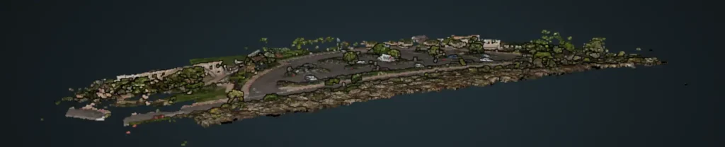
| Dense Points | 7.62 million |
| GPS Source/ CRS | Consumer GPS/WGS84 (No RTK/PPK) |
| GPS Error RMS | 2.10m |
| Outputs | Orthomosaic, DSM, DTM, Point Cloud, Mesh |
Interpretation
Orthomosaic
Produced complete visual coverage of the project area. Stitching and distortion are more pronounced in the Mission 1C model, most evident in parking stall lines, curbs, and roofing. My hypothesis is that this is due to WebODM trying to align perpendicular images with a wide field of view.
Suitable for documentation, visual inspection, asset inventory, and approximate measurements.
Point Cloud
Successfully reconstructed terrain, pavement, vegetation, and major structures. The sparse point clouds were well constructed with 99% of reconstruction points. As expected, building facades, vehicle sides, and tall vegetation were incompletely represented due to the nadir acquisition.
Textured Mesh
Produced a coherent three-dimensional representation of the site. Quality decreased beneath mature trees and along vertical surfaces where image geometry was insufficient. Pavement melted into the vertical surfaces of vehicles.
DSM
Successfully represented overall site topography, including the gradual elevation increase across the parking lot.
Quality Assessment
Strengths
- Complete image reconstruction
- Consistent relative measurement accuracy
- Uniform lighting provided clear visual detail
- No observable large-scale block deformation
- Repeatable acquisition workflow
Limitations
- Absolute positional accuracy is limited by the lack of GNSS corrections
- Missing vertical surfaces & tree occlusions
- Distortion resulting from 90º image stitching
- Vehicle movement introduced localized artifacts
Quality Validation
Relative Measurement Validation
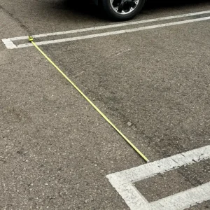
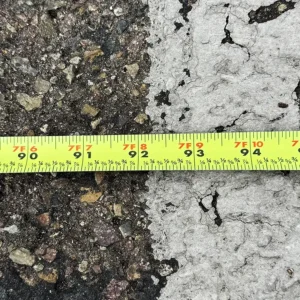
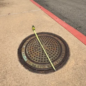
Seven independent field measurements were compared against the reconstructed model.
Results demonstrated relative dimensional agreement generally within 2–4%, with one outlier associated with a table abutting a tall fence, resulting in incomplete capture and measurement inaccuracy.
| Location/object | Lat/Long Coordinates | Actual (inches) | Model (inches) | Delta (Inches) | Signed Error (%) | Model Used |
|---|---|---|---|---|---|---|
| Midway landing on the north stairs (depth) | 33°01'53.67"N 117°16'47.57"W | 48.75 | 47.64 | -1.11 | -2.28% | Ortho |
| Building pillar on NW | 33°01'53.41"N 117°16'47.78"W | 31.75 | 33 | 1.25 | 3.94% | Point Cloud |
| Front face men’s bathroom | 33°01'53.09"N 117°16'47.61"W | 120.375 | 121.32 | 0.945 | 0.79% | Point Cloud |
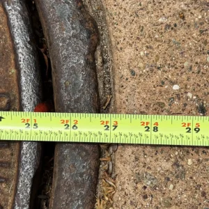
| Manhole cover (parking lot) | 33°01'53.74"N 117°16'47.04"W | 28.875 | 30.06 | 1.185 | 4.10% | Ortho |
| Asphalt patch parking lot | 33°01'52.96"N 117°16'46.88"W | 48.625 | 48.48 | -0.145 | -0.30% | Ortho |
| Top of stairs across pavers (West side, not including white exp joint) | 33°01'53.0"N 117°16'48.1"W | 139.063 | 135.72 | -3.343 | -2.40% | Ortho |
| Tactile strip near HDCP parking (south) | 33°01'52.1"N 117°16'46.8"W | 94.5 | 96.12 | 1.62 | 1.71% | Ortho |
| Steps to pavers (south) | 33°01'52.4"N 117°16'47.5"W | 34.375 | 33 | -1.375 | -4.00% | Ortho |
| Concrete slab near south ballfield (southwest, include white exp joint) | 33°01'52.7"N 117°16'48.3"W | 94 | 95.52 | 1.52 | 1.62% | Ortho |
| Concrete slab near north ballfield (northwest, include white exp joint) | 33°01'53.6"N 117°16'48.5"W | 116.5 | 117.48 | 0.98 | 0.84% | Ortho |
| Dual manhole covers, lower level (northwest) | 33°01'53.5"N 117°16'47.8"W | 43.375 | 43.92 | 0.545 | 1.26% | Ortho |
| Error Calculation | Value |
|---|---|
| Mean Signed Error (Bias) | 0.48% |
| Mean Absolute Error (MAE) | 1.27 |
| Mean Absolute Percent Error (MAPE) | 2.19% |
| Root Mean Square Error (RMSE) | 1.49 |
This dataset is suitable for educational use and approximate measurements but lacks the positional accuracy required for engineering, surveying, or legal-grade geospatial analysis.
Conclusion
Mission 2B turned out to be a lower-quality reproduction than Mission 2A.
The 2D orthomosaic provides adequate visual coverage of the site but exhibits reduced relative dimensional consistency (RMSE 2.42 vs 1.77 on Mission 2A), with field-verified measurements generally within 4% of the observed values. Again, there were significant stitching artifacts on the building’s pitched metal roof and on horizontal surfaces adjacent to vertical surfaces. The narrow palm trees did not render well with occlusion of the trunks and branches.
Again, the point cloud did not reconstruct well. Most of the vertical surfaces were occluded, some more so than Mission 2A. Many of the 90º corners, like curbs, stair steps, and the bases of walls, were very rounded. The building’s corrugated metal roof was occluded, likely due to poor image stitching. There was more noise throughout the model.
Overall, this mission, using a crosshatch pattern with nadir imagery, did not reconstruct well. This dataset in orthomosaic output would be adequate only for a rough asset inventory and progress status. The 3D model is inadequate, with omissions, noise, and warping. The Mission 2A point cloud is of better quality.
Mission 2C Hypothosis
Mission 2C will add oblique capture via 2 orbital passes at different elevations. Mission 2C with nadir and oblique captures may improve the 2D orthomosaic but may also introduce additional stitching issues, similar to how Mission IC introduced more warping and artifacts than the nadir lawnmower capture from Mission 1A. The orbital oblique capture should provide better vertical surface detail but may also introduce additional stitching issues due to multiple camera perspectives, angles, and parallax. The oblique capture should also help the reconstruction under trees and roof eaves.