
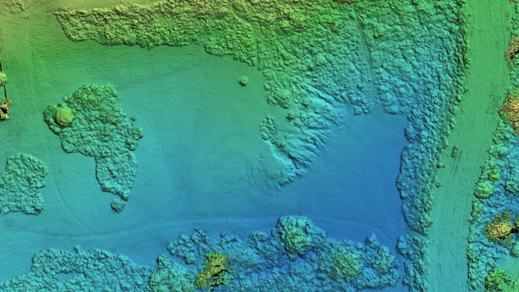
Project Objective
The goal of this project is to demonstrate my skills & ability to generate actionable insights through aerial photogrammetry. Through a series of self-initiated exercises, I created a portfolio of photogrammetry projects that showcase:
- My commitment to safety protocols, mission planning, data organization, and efficient processing workflows to achieve the best possible results with the available resources and equipment.
- My approach to developing a reality capture workflow and resulting datasets that are consistent, accurate, dependable, and repeatable.
By establishing and following an intentional workflow, I produced relatively accurate models suitable for documenting iterative progress, asset inventories, aggregate stockpile measurements, topographic assessments, and general project verification.
More importantly, this exercise gave me an understanding of how to interpret the results and recognize their limitations, shortcomings, and potential errors. As I progress, I will use GNSS control and correction tools to develop models that achieve the highest possible absolute accuracy within my capabilities.
The ultimate goal is to illustrate how the outputs generated here can enhance business intelligence in construction, urban design, architecture, or land use.
Capture Methodology
- Capture Objective
- Capture Technology
- Mission/Capture Parameters
- Survey/Control Methodology
- Processing Workflow
- QA/QC and Accuracy Validation
- Outputs
- Limitations/Intended Uses
In this initial project, I used a consumer-grade DJI Mini 4 Pro, which lacks RTK functionality or GNSS corrections. In addition, I did not have access to, nor did I employ, ground control points or checkpoints for coordinate correction and model alignment.
Without coordinate correction, it’s understood that true absolute accuracy is unattainable and only relative accuracy can be measured. To validate the relative accuracy of my outputs, I compared model measurements with ground-based measurements to assess aerial photogrammetric results across missions using different capture methods and to quantify deviations from reality.
All of these exercises and projects are intended for educational purposes and demonstration, and they are not intended for:
- Engineering design
- Construction layout
- Survey-grade GIS analysis
- Legal boundary documentation
Mission Planning Methodology
Mission Waypoint Creation
I used the DJI Fly app to create missions. The DJI Fly map allows the pilot to create waypoint missions, but it lacks the enterprise-grade features needed for automated, complex mission planning.
To achieve the desired ground sampling distance (GSD) and image quality, I manually calculated grid spacing, photo intervals, altitude, and flight speed, and physically created missions waypoint by waypoint to ensure sufficient coverage and detail.
While time-intensive and cumbersome, manually calculating overlap, flight path spacing, image capture interval, flight speed, and exposure settings proved extremely insightful for identifying the factors to consider for successful image capture. This gave me the fundamentals that I will apply when using more powerful enterprise systems.
Scouting
I conducted a walk-through of each site prior to flying the mission. During the scout mission, I would inspect:
- A safe and unobstructed launch zone that does not create conflict with traffic or any right-of-way
- Emergency landing zones
- Vertical obstacles like power lines and trees
- Potential pedestrian and vehicle traffic
- Surrounding elements that could present issues (nearby helipad, construction sites, bird nests)
- Visual obstructions that could compromise VLOS
- Airspace, weather, lighting, extraneous noise
- Private property adjacent to the mapping site
- Any upcoming special events in the area that conflict with the scheduled mission
- Any local regulations that affect or prohibit the mapping mission
Mission Planning Tech Stack
All elements discovered during the scouting mission are included in the mission plan, which is integrated with information obtained through:
- DJI Fly
- AirData UAV
- FlightRadar24
- Aloft AirControl
- Windy
Processing Methodology
I used WebODM to process my image captures to create orthomosaic maps, digital surface models (DSMs), digital terrain models (DTMs), point clouds (sparse and dense), and textured meshes.
Native 8064 × 6048-pixel images were resized to 6048 × 4536 pixels to facilitate processing. WebODM generated in-depth processing reports detailing reconstruction statistics, feature counts, reprojection error, dense point counts, and accuracy metrics.
Operational Safety Assessment
Risk Evaluation
Hazard | Mitigation |
Airspace and TFRs | Confirmed TFRs and airspace restrictions prior to the mission using AirData UAV. Monitoring nearby or incoming manned aircraft during the mission with FlightRadar24 and VLOS. |
Pedestrians & Vehicle traffic | Selected a launch area away from pedestrian and vehicle traffic while maintaining VLOS and situational awareness throughout the mission. Maintained a 100’ buffer from the adjacent freeway. |
Trees & Light Poles | Planned waypoint spacing during mission planning to maintain safe horizontal and vertical obstacle clearance. Verified obstacle clearance prior to the mission flight. |
Weather | The weather was monitored within 30 minutes prior to and during the mission with Windy. |
Birds | Maintained situational awareness with VLOS and prepared an emergency avoidance and landing procedure to evade birds and terminate the flight if necessary. |
Operational Readiness
- Conduct aircraft inspection
- Battery health verified
- GNSS lock established
- Weather evaluated
- Home point confirmed
- Return-to-Home altitude verified
- Emergency landing area identified
- Conduct Hover Control Test prior to flight
- Visual Line of Sight(VLOS) maintained throughout operation
Training Flights
This portfolio project will consist of separate sites, each with multiple missions. The purpose of each mission is to test specific skills, variables, and/or settings applicable to that site.
Overall learning framework
Capture variables
- Altitude
- Overlap
- Camera Angle
- Flight Pattern
- Lighting
- Environmental Conditions
- Repeatability
Processing outcomes
- Alignment Quality
- Orthomosaic Distortion
- Point Cloud Density
- Mesh Completeness
- Façade Quality
- Vegetation Noise
- Edge Warping
- Reconstruction Confidence
QA thinking
- Measurement Validation
- Repeatability
- Visible Artifacts
- Error Explanation
- Corrective Action
Sites
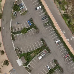
Site 1 — Flat Parking Lot
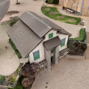
Site 2 — Structure & Surrounding Area
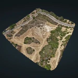
Site 3 — Park / Terrain / Vegetation
Lessons Learned from Project
General
- Organizational skills (Flight log data, imagery, mission requirements, model reconstruction, reporting)
- Established fight planning, flight logging, and processing workflow
Mission Planning
- Mission & Waypoint Creation
- How to manually create a waypoint mission on the DJI Fly app that provides adequate coverage (it took multiple tries)
- Contingency plans (People, traffic, birds, curious inquirers)
- Anticipation of necessary outputs when planning missions and capturing data
Flight Operations
- Pre-flight Operational and Safety Check
- On-site situational awareness (Safety)
- Flying missions in a manner and time to avoid people ( first missions required multiple mission abortions and restarts)
- Objective hazards that are present when mapping a mission (people on site, birds flying in the area, construction on-site)
Processing
- How to read and interpret WebODM results, models, and use measuring tools
- The lack of vertical detail when only capturing nadir imagery
- Reproduction distortion derived from image capture from different perspectives and positions
- Absolute and relative inaccuracies when only using consumer GNSS
- Computer memory and processing settings are needed to build a high-resolution reconstruction
- Determining when to use orthomosaic vs point clouds for different measurements
- Output data translation